
Paths and Byways in Swanton Morley


Swanton Morley is located in the heart of the Norfolk countryside and as such offers plenty of opportunities to walk, cycle and ride on quiet country lanes and across a good network of paths. The 12 mile Wensum Way passes through the village which itself connects to longer distance routes, the Nar Valley Way at Gressenhall and the Marriott's Way at Lenwade. In addition to the public footpaths, bridleways and byways there are also a number of permissive paths where agreement has been made with local landowners to allow public access.
-
Please use the paths considerately
-
If you have a dog please keep it under control and clear up any mess
-
Please also follow the countryside code
*Harkers lane/Green lane is a restricted byway and can be used by walkers, cyclists and horse riders*

Map of Walks in Swanton Morley
Walks

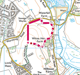
Walk 1
Worthing Road
A short walk of 0.66 km on a permissive path by the woods near Robertson Barracks

Walk 4
Rectory Road to Primrose Hill
A new walk of 0.3 km along a permissive path from Rectory road around the back of Primrose Square to join the public footpath on Primrose Hill
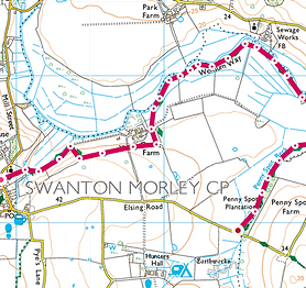
Walk 7
Wensum Way
A longer walk of 4.2 km along a permissive path running from All Saints Church past Castle farm and ending at Pennyspot Plantation on the Elsing road.
Please be aware that there may be Cattle roaming on this walk and dogs should be kept on leads

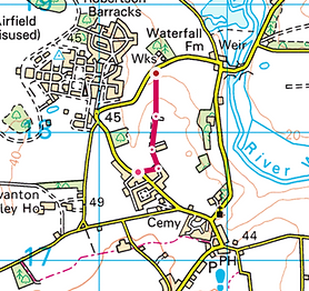
Walk 10
Lincoln House
A walk of 1.2 Km along a permissive path around the field behind Lincoln House
Walk 2
Wensum Valley Views
A walk of 1.7 km on a permissive path with lovely views across the Wensum valley

Walk 5
Green Lane and Harkers Lane
A walk of 1.7 km along the restricted byways of Green Lane and Harkers Lane
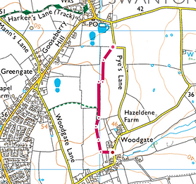
Walk 8
Pye's Lane to Woodgate
A walk of 0.9 Km along a public footpath running from Pye’s Lane To Woodgate
Walk 3
Primrose Hill
A walk of 1 km along the public footpath on Primrose Hill

Walk 6
Green Lane (Track) to Hoe Road North
A short walk of 0.2 km along a permissive path linking Hoe Road East and Harkers Lane

Walk 9
Woodgate Lane to Walk 8
A walk of 0.4 Km along a public footpath running from Woodgate Lane and joining Walk 8